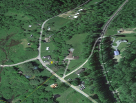
Yes, I went there to Gardeau many times, many years ago. Location of balance of heavy silver bars had been narrowed down to side of hill ( about 700 yards) Too old now, with bad arthritis and Cancer. Someone else (athletic type) needs to go there. I sold report to a Pa man, but no response back. I hope it was not just some kid with money to spend on things with no intention to hiking. . I did full back articles research and took many photos in that area. The topographic quadrant map is compared with old 1800's map, and modern map. 1 1/4 miles walk from main road to junction trails. (Locked gates to keep out people with sparks from engines next to woods) I was there before gates put up. Coyote pack tracks roam the dirt logging trail. Large water snake seen. There are always unknown dangers while hiking in the wilderness. Gun protection needed and sat phone in mountains. Boot spikes such as ice fishing strap-on are necessary along with lightweight aluminum walking pole for steadiness on uneven ground, and emergency rain suit. This is the real location area , West of Gardeau,- not the one farther North with the other salt lick. Got it?
The original story had only a few clues. The depositors came back after 10 years to retrieve the hoard. The markings on trees were gone that associated with the map. Settlers moved in and cut down trees. The map had a very large salt lick near the mountain. When I was there, I found the salt lick. Some deer passed close by me and stopped, twitching their tails and looking around. They proceeded to lick the ground for 10 minutes. Yes , I went there and tasted the salty dirt. It's all over grown weeds and soft mossy ground. (Near the creek) The only other clue was that 2 trenches were dug for the silver, and covered up with rocks. You can figure this out , the way I did, by learning about operating a wagon with a long 3 sets of dual OXENS. The way it has to be done to move them around. Think like the driver + what he has to do. The dirt logging road is narrow straight, up to a turn off.
I was greatly elated to find out that the original log bridge of DEC 1811 was actually there for the 6 wagons pulled by 6 oxen, to pass over creek to the other side! I had 3 X's marked on map for 1st, 2nd, and 3rd spot figured as the locations. After finding the bridge data ,..........that eliminated lots of time wasted with spots 1+2.
In 2008 four deer hunters went into that area. One was from the city, not knowing anything about history of Gardeau. In Pa. they get what's called "flash rain" It comes down in torrents, and then stops. . The hunters got soaked, so they turned and made their way back to the 4 wheelers. They then went to local fast food diner and the one talked about the stack of metal sticking out of the ground,he saw in the woods of the mountain. The others got all excited, and said the guy had found the lost treasure of Gardeau. The 4 went back to the mountain 4 more times , but found nothing. The hunter had taken a short cut walking back , not the same way he went into the woods.
Some SILVER bars were found loose with 1800's pistol on side of mountain slope in 2006. That didn't make sense, so I figured out a possible scenario based on Parker during the 1800's being drunk. By not capable of ascending his horse, he had to take a buggy + horse down the trail (Silver mine Run - Parker Run) to the spot with marker. He then ascended straight up the STEEP slope and filled his leather saddle bag. He then slipped, fell down , dumping is loot, and got back up, continued down the slope to the buggy. If he was sober, ON HIS SEPARATE HORSE to begin with, going through the woods, the bars would be safe in the horse saddle bag. The lost today's value 18 Million dollars worth of treasure of Gardeau is a reality. There's more data.
Material from ship was off loaded to wagons New Jersey port, and treked up through Pa towards N.Y. The mass was originally buried because of the upcoming soon War of 1812. 1800's ship chain was found embedded in 100year old tree and recovered and verified. Mr. Parker landowner of 1800's, withdrew some bars he found after searching in 1860's to have contractor build 2 buildings. He never told relatives the exact location. My friend and I found Mr. Parker's well he drilled , trying to get oil, but he got healing minerals water that he sold to customers. Look up photo of flat dark gray slate section. That's what large silver bar looks like after many years in woods. This is a real treasure hunt expidition only for the hardy type for rough hiking and had previously assembled back pack of assorted materials , such as wire, duct tape, binoculars, knife, water, paper, pen etc. Sore legs for 2 days but so what.
This could be more easily done with one of those flying drones with infrared or other type camera to get photos underneath the craft. That's how the us gov does it. Also heat photos from evening , after dark, because metal under dirt absorbs the sun's SUMMER heat during day, then releases it at dark.

